

描述
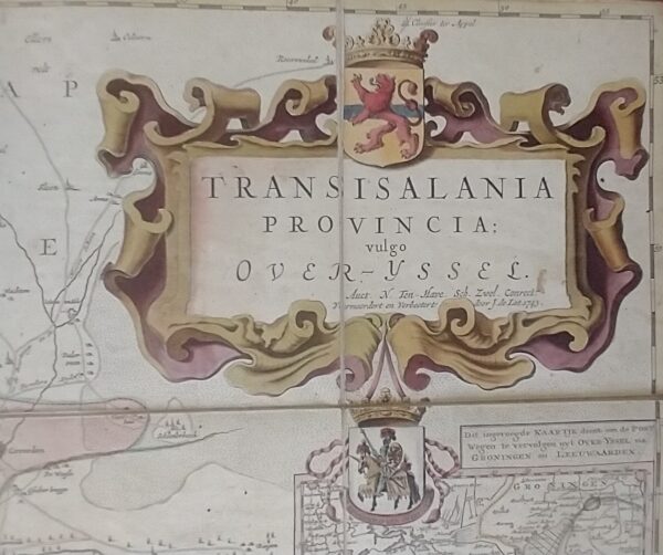
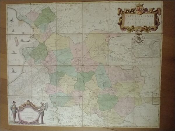
This large-format map of the province of Overijssel was published in 1743 by the Deventer publisher Jan de Lat. In the upper right corner, within a cartouche, appears the official title: “Transisalania Provincia vulgo Over-Yssel” (Latin for: Province of Overijssel, commonly called Over-Yssel). Beneath this title, in cursive script, is written: “Auct. N. ten Have. Sch. Zwol. Conrect. Vermeerdert en verbetert door J. de Lat 1743.” This indicates that Nicolaas ten Have (1604–1650) was the actual designer of this map. He issued the first edition of this rare large-format map in 1639, measuring 101 × 140 cm. The map was intended, among other purposes, to help resolve border disputes.
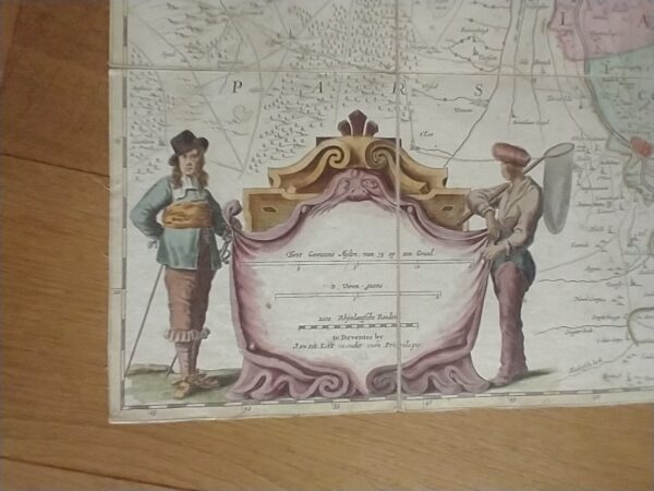
Much later, the Deventer publisher Jan de Lat acquired the copper plates, enabling him to republish the map in a reduced format in 1743, while acknowledging the original source. Beneath the aforementioned cartouche appears a small inset map with the title: “Dit ingevoegde kaartje dient op de postwegen te vervolgen uyt Over-yssel na Groningen en Leeuwarden” (“This inset map serves to continue the postal routes from Overijssel to Groningen and Leeuwarden”).
The large-format map offered here is an example with its original hand colouring, printed from copper engravings on 24 separate sheets. These sheets were mounted on linen — possibly in the early nineteenth century.
Dimensions of each sheet: 21.5 × 17.8 cm.
Overall dimensions: 106.5 × 85.5 cm.